Related Post

Tampilkan postingan dengan label Books. Tampilkan semua postingan

Indonesia Truly Atlantis

Studio Spasial - Judul buku ini sebenarnya "Atlantis, The Lost Continent Finally Found" yang dicetak dalam bentuk buku Paperback. Buku itu sedikit mengingatkan saya pada iklan tentang pariwisata Malaysia : Malaysia, Truly Asia. Pasti banyak dari kita yang sebel dengan iklan itu, karena kebanyakan yang digambarkan dalam iklan itu sebenarnya justru lebih banyak ditemui di Indonesia daripada Malaysia. Namun apa mau dikata, seperti peribahasa gajah di pelupuk mata tidak kelihatan semut diseberang lautan nampak, kita seperti kecolongan karena kurang memperhatikan budaya kita. Seperti juga konon banyak bule yang lebih tahu Bali daripada Indonesia, karena budaya Bali lebih kental dan berkesan bagi banyak wisatawan.

atlantis_finally_found

More Review on Amazon

Perkembangan kondisi terbaru cukup mendukung Indonesia dalam promosi budaya, ibarat mendayung perahu ke hilir, yang mendapat dorongan arus sungai dari belakang. Banyak kemudahan yang didapat secara gratis. Seperti pengakuan terhadap batik baru-baru ini. Buku yang ditulis oleh Prof. Arysio N. dos Santos baru-baru ini, yang saya pikir cukup fenomenal dan menggemparkan sepertinya akan turut berdampak pada semakin dikenalnya eksistensi Indonesia di mata dunia international. Ga sabar pingin tahu kenapa? Beli aja bukunya lewat link judul bukunya : “Atlantis the Lost Continents Finally Found” atau kalau mau baca review lebih jauh mengenai buku ini klik more review on Amazon.
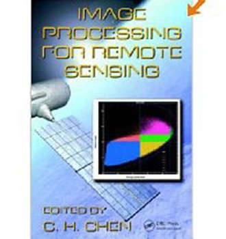
Image Processing for Remote Sensing

Spatial Book – This Image Processing for Remote Sensing book explores new and unconventional mathematics methods. The coverage includes the physics and mathematical algorithms of SAR images, a comprehensive treatment of MRF based remote sensing image classification, statistical approaches for improved classification with the remote sensing data, Wiener filter-based method, and other modern approaches and methods of image processing for remotely sensed data.

Image-Processing-for-Image-Processing

More Review on Amazon

Each chapter explores a technique for dealing with a specific remote sensing problem. The book offers physical insights on the steps for constructing various digital seismic images. The volume examines image modeling, statistical image classifiers, change detection, independent component analysis, vertex component analysis, image fusion for better classification. It explores unique topics such as accuracy assessment and information-theoretic measure of multiband images and many chapters emphasize issues with synthetic aperture radar (SAR) images.

Continued development on imaging sensors creates new opportunities and challenges in image processing for remote sensing. Image Processing for Remote Sensing not only presents the most up to date developments of image processing for remote sensing but also suggests to readers the many challenging problems ahead for further study. More Review on Amazon.

Image Analysis, Classification and Change Detection in Remote Sensing : With Algorithms for ENVI/IDL

Spatial Book – Image analysis has become an essential part of remote sensing, along with the increasing availability of aerial and satellite Earth observation data. Image Analysis, Classification and Change Detection in Remote Sensing : With Algorithms for ENVI/IDL is a book that combines theory, algorithms, and computer codes and conveys required proficiency in vector algebra and basic statistics. It covers such topics as basic Fourier transforms, wavelets, principle components, minimum noise fraction transformation, and othorectification. The text also discusses panchromatic sharpening, explores multivariate change detection, examines supervised and unsupervised land cover classification and hyperspectral analysis. With programming examples in IDL and applications that support ENVI, it offers many extensions, such as for data fusion, statistical change detection, clustering and supervised classification with neural networks, all available as downloadable source code.

Image_Analysis_Classification_and_Change_Detection_in_Remote_Sensing_With_Algorithms_for_ENVI_IDL, remote sensing book

More Review on Amazon

Focusing on pixel-oriented analysis of visual/infrared Earth observation satellite imagery, this book extends the ENVI interface in IDL in order to implement new methods and algorithms of arbitrary sophistication. All of the illustrations and applications in the text are programmed in RSI's ENVI/IDL. The software and source code is available for download at : http://www.crcpress.com/e products/downloads/default.asp.
This book is ideal for undergraduate and graduate student, this book provides exercises and small programming projects at the end of each chapter. A solutions manual is also available. More Review on Amazon.

Remote Sensing and Image Interpretation

Spatial Books – This Remote Sensing and Image Interpretation book content a comprehensive introduction to Remote Sensing that covers the science from physical basis to sensors and applications. It is not a how to do it book as opposed to a complete textbooks for students in this area who need good background of the science and its application. We can use it as a good textbook for solid foundation prior to more practical texts on how to do it.

Remote-Sensing-and-Image-Interpretation

More Review on Amazon

I am reading this book for an introductory course in Remote Sensing. I thoroughly enjoy the level of detail and the presentation of quantitative methods for analyzing data. The text can be somewhat dry (and dense) at times and difficult to digest, but for the most part, it manages to stay interesting. There are a lot of illustrations (including a whole section of color plates) that the student can reference. Also, the scope of the book is broad enough to be suitable for an introductory course, but still manages to stay focused (only 8 chapters!). More Review on Amazon.

Remote Sensing for GIS Managers

Info Spasial - Remote Sensing for GIS Managers is a book that incredibly readable even for someone just getting started in Remote Sensing and GIS managing. Visual stunning pictures and enlightening figures dot every single page. I highly recommend this book to anyone interested in the science and practice of GIS management.

Remote Sensing for GIS Managers

More Review on Amazon

Remote sensing technology is changing not just government pursuits, but our daily lives, and Remote Sensing for GIS Managers surveys the uses and applications of GIS using color images and illustrations to explore such diverse fields as agriculture, business, urban planning and more. Little prior information is assumed here : chapters start with the basics such as the characteristics of GIS data and moves to more advanced topics on managing and storing such data. From digital and video cameras to wavelength processing and active sensors, Remote Sensing for GIS Managers is easy to access, yet packed with technical information. More Review on Amazon.

Getting to Know ArcObjects

Spatial Info – Looking for a book to start learning ArcObjects? This book is a good place to start on ArcObjects. As the title suggests, this book is devoted to teaching the basics of programming with ArcObjects, and it does an outstanding job. It primarily deals with the designing of interfaces, rather than using the commands for automation. Good introduction to the concepts of the ArcMap Object model, properties, methods, and events, there's even a little blurb or cursors. Content in this book also covers a little of ArcCatalog. Just for information, ArcTools does not follow the ArcObject Model, so if you are looking for properties, methods and events pertaining to this, and you are using ArcGIS 8.x, I guess you need to upgrade yours to ArcGIS 9.x. Also, there are no scripting capabilities similar to AML on ArcGIS 8.x, you'll have move to ArcGIS 9.x, where python is used as the scripting language to replace AML. Also, does not address OOP concepts on the GeoDatabase model very much, but this book is definitely better than Getting to Know ArcGIS Book

ArcObjects_Book, getting to know ArcObjects

More Review on Amazon

A lot of reviewers have summarized the book (Getting to Know ArcObjects) well, although I do think that some had more advanced expectations, even though the title of the book makes it clear that it only covers introductory material. Overall, what impressed me most was Burke's exceptional ability to take complex concepts (like interface-based programming) and explain them in a clear and concise manner. The writing is impeccable, and I found very few flaws in the book, which is incredibly uncommon for computer books. Obviously, a great deal of care and attention went into the preparation of this book. The reader won't be disappointed. I currently own every ArcObjects book in print, and in my opinion, this is the only book useful for those trying to learn ArcObjects. Highly recommended. More Review on Amazon.

An A to Z GIS Handbook

Studio Spasial – Have you read or using this book? Usually books about GIS are quite technical, surveying the applications and computer potentials of geographic information systems (GIS). So it's refreshing to note that A TO Z GIS : AN ILLUSTRATED DICTIONARY OF GEOGEPHIC INFORMATION SYSTEMS is something different, a simple set of geography and cartography definitions designed to defines values, coordinates, reference systems, representations, and GIS data processing methods and routines. Students of GIS will find this essential to understanding the terminology of both computer and geography worlds.

a-to-z-gis-handbook, gis dictionary

More Review on Amazon

I found this book useful while studying for exams and oral examinations during my Masters program. The things to remember is this is a ESRI book and uses their terminology. If you are a student I would recommend this book to use a reference. The book isn't going to teach you GIS, it is meant to be used as a reference. So I would still buy the required books for your class. More review on amazon.